Fighting Deforestation in the Amazon: Strategic Coordination and Priorities for Federal and State Governments
The Brazilian government plays a key role in protecting the Amazon Forest. On the one hand, several government agencies are directly responsible for both managing public designated lands and incorporating and designating undesignated public forest.[1] On the other hand, the government is also responsible for implementing the Forest Code, a law that determines the rules on conversion of native vegetation and land use in private areas in the Amazon biome.
Public policies play an essential role in curbing the recent acceleration of deforestation and reversing the increasing trends observed over the last decade (Figure 1).[2] In Brazil’s current context of resource scarcity, the execution of such policies requires focusing public efforts on areas with greater potential for impact. In this study, researchers from the Climate Policy Initiative/ Pontifical Catholic University of Rio de Janeiro (CPI/PUC-Rio) analyze deforestation and land tenure within the Amazon biome to identify critical areas for public authorities to address in each territory. The analysis identifies three priority strategies for action.
The federal government should prioritize fighting deforestation in rural settlements, reconciling forest protection with the guarantee of livelihoods for settled populations. State governments, in turn, rely on the implementation of the Forest Code as their main tool to fight deforestation on private lands. These state efforts can—and should—be supported by the federal government. In addition, the Union and states must act, in a complementary and coordinated manner, to promote territorial zoning of undesignated public areas and areas with no land tenure data available. These territories have been targeted by illegal occupations associated with forest destruction. It is imperative for the government to incorporate, register, regulate, and designate such areas.
Results highlight the importance of coordination and cooperation between the federal and state governments to ensure the effective protection of the Amazon Forest.
Figure 1. Deforestation in the Amazon Biome, 2012-2021
Note: The graph presents the total area deforested each year within the Amazon biome. It is important to note that this number differs from the deforestation rate for the Legal Amazon. In addition, the preview of the deforestation rate for the Legal Amazon for the PRODES-year 2022, released on November 30, 2022, was 11,568 km². Spatial data for this year are not yet available and therefore could not be incorporated into this analysis.
Source: CPI/PUC-Rio with data from PRODES/INPE, 2022
Land Tenure Structure of the Amazon Biome
Based on the land tenure categories, this analysis classifies the Amazon biome areas as federal public, state public, private, areas with no land tenure data available, or others. Figure 2 shows how these areas are distributed among the land tenure categories, which are briefly described in the Glossary of Land Tenure Categories of the Amazon Biome.[3] Figure 3 shows the composition of states by biome and type of area.
Land tenure in the Brazilian Amazon is complex. Databases currently available have inconsistencies and significant overlaps between the areas registered in the different land registries across the country. The treatment given to such inconsistencies and overlaps is crucial to the construction of a land tenure map and, consequently, the calculation of areas associated with it.
This study uses the land tenure georeferenced database from the 2021 Atlas of Brazilian Agriculture[4] as its main source of information. Developed by IMAFLORA and GEOLAB from ESALQ/USP, the database is built from georeferenced land registries. Details on the use of additional information sources and the treatment of spatial data are discussed in the methodological note of this document.
Figure 2. Land Ternure Composition of the Amazon Biome, 2021
Note: The Amazon biome covers 4.2 million km². The numbers in the graph indicate the percentage of the biome corresponding to each type of area and land tenure category. The diagram does not include rural settlements and conservation units under municipal responsibility, nor rural settlements for which it was not possible to determine the responsible government sphere. Together, these territories represent less than 0.02% of the area of the Amazon biome.
Source: CPI/PUC-Rio with data from IMAFLORA and GEOLAB, CNFP/SFB, CNUC/MMA and INCRA, 2022
Figure 3. Composition of the States in the Amazon Biome by Types of Area, 2021
Note: The analysis only includes parts of states that are within the Amazon biome.
Source: CPI/PUC-Rio with data from IBGE, IMAFLORA and GEOLAB, CNFP/SFB, CNUC/MMA, INCRA and PRODES/INPE, 2022
Deforestation by Type of Area
The distribution of deforestation between public and private areas in the Amazon biome has changed little over the last decade. Forest loss occurred mainly in federal public areas and private properties, which accounted for, respectively, 45% and 28% of the deforested area between 2012 and 2021. Deforestation totaled more than 55,000 km² in these territories over this period.
There was, however, a significant increase in the level of deforestation observed mainly in federal public areas and areas with no land tenure data available in recent years. Between 2018 and 2021, the deforested area in these territories increased 91% and 74%, respectively. For comparison purposes, during the same period, deforestation in private areas—despite significant increases—saw a 58% increase.
These patterns show that, in terms of scale, federal territories should be prioritized in the fight against deforestation on public lands. The scope where state action can achieve the greatest impact, in turn, is private land. It should be noted that states are responsible for implementing the Forest Code, the main legal instrument for forest protection on private properties. In addition, both federal and state government agencies are responsible for land use planning in areas with no land tenure data available to reduce forest loss in these territories.
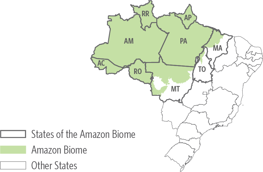
Considering that states have different land tenure structures, it is expected that deforestation patterns naturally differ between them. It should be noted that forest loss on federal public lands is particularly significant in the states of Pará and Amazonas but has recently accelerated in Acre and Rondônia. Deforestation in areas with no land tenure data available is concentrated in Pará, Mato Grosso, and Rondônia. Deforestation in private areas is mainly distributed among four states (Pará, Mato Grosso, Amazonas, and Rondônia), with a concentration of deforested areas in Mato Grosso and Pará, and a notable recent acceleration in Pará and Amazonas. The states of Amapá, Maranhão, and Tocantins did not show relevant levels of deforestation in the period, as they have little native tropical vegetation and occupy relatively small territories within the Amazon biome.
To hone in on critical areas for the fight against deforestation, this analysis explores trajectories of forest loss by land category, assessing federal public areas, state public areas, areas with no land tenure data available, and private areas separately. For each area type, it presents detailed trajectories referring to the states of Acre, Amazonas, Mato Grosso, Pará, and Rondônia. Together, these five states accounted for 95% of the deforested area within the Amazon biome between 2012 and 2021.
Figure 4. Deforestation in the Amazon Biome, 2012-2021
Source: CPI/PUC-Rio with data from IBGE, IMAFLORA and GEOLAB, CNFP/SFB, CNUC/MMA, INCRA and PRODES/INPE, 2022
Federal Public Areas
Rural settlements accounted for 54% of deforestation in federal public areas between 2012 and 2021, with almost 45% of forest loss in this category occurring in Pará. In addition to affecting large areas, deforestation in these territories is advancing at an accelerated pace. As of 2019, there has been a significant increase in forest loss in settlements in Pará, but also in Acre and Amazonas. A sustainable development strategy for the Amazon region needs to align the promotion of social and economic development of settlers with forest protection in federal settlements.
Public forests that have not yet been designated for specific use constitute the territories with the highest concentration of deforestation in federal public areas, following settlements. Almost 80% of the 101,700 km² area is registered as private properties in the SICAR, an indication of illegal occupation. It is precisely these occupied areas that concentrate 91% of the deforestation that occurred in this land tenure category between 2012 and 2021. Forest loss in undesignated federal public forests, which had been on the rise since the beginning of the analysis period, accelerated significantly starting in 2019. A similar but less significant trajectory was observed in the territories covered but not titled by the Terra Legal Program,[5] which ended in 2018. These territories typically already have some degree of occupation since they were included in the federal land titling program. Deforestation in undesignated federal public forests and in areas under the Terra Legal Program that were not titled is concentrated mainly in Pará and, to a lesser extent, in Amazonas and Rondônia.
The results highlight the importance of focusing efforts to fight deforestation on federal public areas with weaker land tenure. Considering that these areas are already occupied, albeit partially, it is crucial for forest protection measures to be accompanied by actions geared towards territorial ordering of undesigned areas, as well as land regularization.
It should also be noted the forest loss in indigenous lands and federal sustainable use conservation units increased in recent years. This increase occurred mostly in the state of Pará, but also in sustainable use conservation units in Acre and in indigenous lands in Mato Grosso. Despite representing a relatively low share of deforestation in federal public areas, the advance of deforestation in these protected territories serves as a warning for federal authorities to act to ensure that legal protection is effectively afforded to them.
Figure 5. Deforestation in Federal Public Areas of the Amazon Biome, 2012-2021
Note: The figure presents only the trajectories related to the five states that together accounted for 95% of the deforested area within the Amazon biome between 2012 and 2021.
Source: CPI/PUC-Rio with data from IBGE, IMAFLORA and GEOLAB, CNFP/SFB, CNUC/MMA, INCRA and PRODES/INPE, 2022
State Public Areas
Deforestation in state public areas occurs on a smaller scale than in federal areas. However, the pattern of forest loss in state areas with no specific designation is similar to that at the federal level. Undesignated public forests accounted for 52% of deforestation in state areas between 2012 and 2021, showing a clear acceleration of forest loss as of 2019. There are indications that, as in the federal case, undesignated areas have been the target of illegal occupation. Private property records in the SICAR occupy almost 12% of the 304,000 km2 of the undesignated public state forests and account for 60% of the deforestation that occurred in the land tenure category during the period of analysis. This reinforces the importance of designing efforts to combat land grabbing and improve land designation at the state level as well.
Acre, Amazonas, and Pará showed concentrated deforestation in undesignated state public forests between 2012 and 2021, but Amazonas stands out as the state with the highest recent level of deforestation in this land tenure category. This is particularly relevant given the discussion on the possible impacts of infrastructure works in the region, such as the BR-319 highway, whose reconstruction could affect a large area of undesignated public forest in the state.[6]
The second trajectory that stands out in state public areas concerns deforestation in sustainable use conservation units, which represents 40% of forest loss in state areas during the period under analysis. However, most of this loss is concentrated in Rondônia, indicating that states will need to adopt different strategies based on their local context.
Figure 6. Deforestation in State Public Areas of the Amazon Biome, 2012-2021
Note: The figure presents only the trajectories related to the five states that together accounted for 95% of the deforested area within the Amazon biome between 2012 and 2021.
Source: CPI/PUC-Rio with data from IBGE, IMAFLORA and GEOLAB, CNFP/SFB, CNUC/MMA, INCRA and PRODES/INPE, 2022
Areas with no land tenure data available
Deforestation in areas with no land tenure data available accounted for 21% of forest loss between 2012 and 2021, with a clear acceleration since 2019. Nearly half of this loss occurred in areas registered only in the SICAR. In 2021, 53% of the registered area had already been deforested. Although Pará and Mato Grosso show higher concentrations of deforestation in areas with no land tenure data available, the recent upward trend in Acre, Amazonas, and Rondônia shows that this issue is not restricted to a single region.
Existing CAR registries in areas with no land tenure data available indicates an occupation of public areas and reinforces the importance of advancing with territorial ordering. It is not possible to establish specific responsibility in territories that are not included in land registries.[7] The government needs to incorporate and designate unregistered areas, as well as to identify occupations that may be subject to land regularization. Territorial ordering in the Amazon is not only a way to combat land insecurity in the biome, but also to protect the forest.
Figure 7. Deforestation in Unregistered Areas in the Amazon Biome, 2012-2021
Note: The figure presents only the trajectories related to the five states that together accounted for 95% of the deforested area within the Amazon biome between 2012 and 2021.
Source: CPI/PUC-Rio with data from IBGE, IMAFLORA and GEOLAB, CNFP/SFB, CNUC/MMA, INCRA and PRODES/INPE, 2022
Private Areas
Private properties accounted for 28% of the entire deforested area in the Amazon biome between 2012 and 2021 and are a critical front in the fight against deforestation. Despite an upward trend since 2012, forest loss in these areas also accelerated as of 2019. This acceleration happened in the states of Acre, Amazonas, Pará and Rondônia. Mato Grosso differs from the other states for showing a clear concentration of deforested area in large properties and an increase in deforestation since the beginning of the period under analysis.
These trajectories show the annual advance of deforestation, but the analysis also calculates the extent of accumulated forest loss up to 2021 in relation to the total area occupied by private properties in the Amazon biome. Sixty-seven percent of the territory occupied by small properties, 45% by medium properties, and 33% by large properties have already been deforested. In addition to revealing the magnitude of forest loss that has already occurred within private areas in the Amazon biome, these figures reinforce the urgent need to stop deforestation in these areas. To this end, it is essential that public authorities move forward with the implementation of the Forest Code, the main public policy instrument for the protection of native vegetation on private lands.
Though the Forest Code is a federal law, it is implemented at the state level. The states are also primarily responsible for inspecting and enforcing the law in private areas, since they are responsible for the environmental licensing process in those areas. The federal government’s actions in private areas should be conducted in coordination with state governments.[8]
Given the magnitude of deforestation in private areas and considering the responsibility that the states have over the environmental control in these areas, it is imperative that state authorities prioritize the implementation of the Forest Code.[9] It is important to highlight that the federal government plays a central role in supporting state governments in this agenda. Examples of federal action to advance the implementation of the Forest Code include the development and management of SICAR, as well as the development of tools and the provision of critical inputs to support the implementation of CAR at the state level. Coordination between federal and state governments is therefore essential to fight deforestation in the region.
Figure 8. Deforestation in Private Areas of the Amazon Biome, 2012-2021
Note: The figure presents only the trajectories related to the five states that together accounted for 95% of the deforested area within the Amazon biome between 2012 and 2021.
Source: CPI/PUC-Rio with data from IBGE, IMAFLORA and GEOLAB, CNFP/SFB, CNUC/MMA, INCRA and PRODES/INPE, 2022
Public Policy Implications
Public policies are key in fighting deforestation in the Amazon. Coordination between federal and state entities responsible for executing these policies is essential to exploring complementarities and, thus, increase the effectiveness of government actions.
The pattern of deforestation by land tenure category over the last decade points to paths for prioritizing action. The federal government must prioritize the development of a strategy for rural settlements, protecting forests while ensuring the economic viability of these territories. The states, with federal support, must prioritize the implementation of the Forest Code, with emphasis on the analysis of CAR records as a critical monitoring tool.
It is also important to move forward with the territorial ordering efforts, which include incorporating unregistered land, resuming control of illegally occupied public areas, promoting land regularization, and designating undesignated areas. This will require a joint effort between the federal and state governments.
This analysis uses land tenure information to prioritize strategies for government actions, aiming at increasing their impact and effectiveness. The complexity of the land tenure situation in the Amazon and data limitations make it impossible to unequivocally identify the land tenure structure of the entire biome. Consequently, different methods can yield different numbers. Improving the quality of public data and the integration between them is the responsibility of public authorities and a fundamental step towards greater transparency.
Methodological Note
The analysis presents the trajectory of the area deforested each year within the Amazon biome between 2012 and 2021 (the last year for which deforestation data is available), considering the land tenure category in which forest loss occurred. The areas in each category are classified according to the following five types: federal public, state public, areas with no land tenure data available, private, and others.
The deforested area is calculated based on spatially explicit data (in vector format) from PRODES/INPE, which provides the official history of deforestation in the Brazilian Amazon.[10] The land tenure category for each area is identified from a combination of data sources. The 2021 Atlas of Brazilian Agriculture, created by IMAFLORA and GEOLAB from ESALQ/USP,[11] is used as the main source of land tenure information. Land tenure categories associated with a single type of area are classified according to the land tenure georeferenced database in the Atlas. Examples include indigenous lands, which are federal public areas, and private properties, which are private areas. The Atlas does not, however, distinguish between federal and state areas for land tenure categories that include areas of both types. In these cases, the information was complemented with data from the Brazilian Forestry Service (Serviço Florestal Brasileiro – SFB) for type-B public forests,[12] the National Registry of Conservation Units (Cadastro Nacional de Unidades de Conservação – CNUC) for conservation units[13] and the National Institute for Colonization and Agrarian Reform (Instituto Nacional de Colonização e Reforma Agrária – INCRA) for rural settlements.[14]
There is significant overlap between land tenure categories in the Brazilian Amazon. To address these inconsistencies, the Atlas defines and applies a hierarchy among land tenure categories.[15] This analysis adopts a slightly modified version of this same hierarchy. The only change is that rural areas registered in the SICAR do not have priority over type-B public forests. Therefore, in the case of overlap between these categories, the CAR is disregarded, and the area is considered an undesignated public forest. The analysis also uses this procedure to calculate the extent of occupation of undesignated public forest areas.
The authors would like to thank Patrick Aleixo and Marcelo Sessim for research assistance; Juliano Assunção, Cristina Leme Lopes, Joana Chiavari, and members of Amazônia 2030 for the comments; Natalie Hoover, Giovanna de Miranda, and Camila Calado for the editing and revision of the text; and Nina Oswald Vieira and Julia Berry for formatting and graphic design.
[1] Public owned forest with unassigned use by the government.
[2] The analysis covers the 2012-2021 period, but the years refer to the so-called “PRODES-year”, a 12-month period used by the National Institute for Space Research (Instituto Nacional de Pesquisas Espaciais – INPE) to record annual deforestation. For example, PRODES-year 2021 includes the deforestation that occurred between August 2020 and July 2021. It should be noted that the preview of deforestation rate for the Legal Amazon region for the PRODES-year 2022, disclosed on 11/30/2022, was 11,568 km². The geographic information for this year is not available yet, as a result it could not be incorporated into this analysis.
[3] For a detailed discussion of Brazilian land tenure categories, see: Chiavari, Joana, Cristina L. Lopes, and Julia N. de Araujo. Panorama dos Direitos de Propriedade no Brasil Rural. Rio de Janeiro: Climate Policy Initiative, 2021. bit.ly/PanoramaRural2021.
[4] IMAFLORA and GEOLAB. Atlas da Agropecuária Brasileira. bit.ly/3Ofa7yR. Access date: September 30, 2022.
[5] The Terra Legal Program was launched by the federal government with the aim of promoting land regularization in the Legal Amazon. It is based on Law no. 11,952/2009.
[6] Araujo, Rafael, Arthur Bragança, and Juliano Assunção. Accessibility in the Legal Amazon: Delimiting the Area of Influence and Environmental Risks. Amazônia 2030, 2022. bit.ly/3e1ppJf.
[7] CAR is an environmental control instrument that does not reflect land tenure rights.
[8] The Brazilian Federal Constitution of 1988 provides for the shared responsibility of the federal government, states, Federal District and municipalities in protecting the environment and preserving forests, fauna and flora. Historically, environmental control in the Amazon was mainly carried out by federal agencies. This is changed in 2011, when the law 140/11 established the rules for cooperation between federative entities, including the federal government and the states, for administrative actions to protect the environment and preserve forests, fauna and flora. The rules state that the entity that grants licenses has the primary responsibility to supervise and enforce environmental law. As a result, the states became primarily responsible for enforcing the law on the suppression of native vegetation in private areas, since they grant the licenses for this suppression. The actions of the federal authority within these areas must, therefore, be carried out in coordination with the state authorities.
[9] For more detail on the Forest Code and its implementation, see: CPI’s. Forest Code Implementation Monitor. 2022. bit.ly/MonitordeImplementacaoCF.
[10] Instituto Nacional de Pesquisas Espaciais (INPE). PRODES – Monitoramento do Desmatamento da Floresta Amazônica Brasileira por Satélite. bit.ly/3xEMgQ0. Access date: July 07, 2022.
[11] IMAFLORA and GEOLAB. Atlas da Agropecuária Brasileira. bit.ly/3Ofa7yR. Access date: September 30, 2022.
[12] Serviço Florestal Brasileiro (SFB). Cadastro Nacional de Florestas Públicas. bit.ly/3hTwRIx. Access date: September 29, 2022.
[13] Ministério do Meio Ambiente (MMA). Cadastro Nacional de Unidades de Conservação. bit.ly/3ArFlwS. Access date: March 14, 2022.
[14] Instituto Nacional de Colonização e Reforma Agrária (INCRA). Projetos de Assentamento Total. bit.ly/3Anl23t. Access date: October 19, 2022.
[15] The criteria for building this hierarchy are detailed in: Freitas, Flávio et al. Malha Fundiária do Brasil. Atlas – A Geografia da Agropecuária Brasileira, 2018. bit.ly/3OsI9zs. It should be noted that the 2018 technical note is the methodological reference for the 2021 version of the land tenure georeferenced database.
